
I have described Wyoming as a terrible beauty. It is a state of dramatic mountains, sagebrush steppes, sweeping prairies, and desert. I have attempted in many conversations to separate the “Terrible” from the “Beauty.” I was reminded of this distinction in May,2021 as we explored a part of Wyoming we had not seen.
As a Wyoming native, most of my life has been spent in the nearby Big Horn Mountains where we hunted, camped and ran livestock in the summer months. A state known for its iconic national parks–Teton and Yellowstone–which we have visited many times, it is also a state with a great desert which we had not visited. Our search for new terrain led us to the Red Desert, a wild, largely roadless area that is one of the last unfenced landscapes in the United States.
The Red Desert in Southwest Wyoming is a special place that rarely appears in state tourism information. Known for mining, mineral and oil and gas development, it is easy to overlook the natural beauty of a place that is intersected by Interstate 80, with endless streams of semi-trucks headed coast-to-coast. Fierce windstorms toss the trucks around like straws and close the highway frequently in winter. The Union Pacific, the nation’s first transcontinental railroad passed through the desert, as well as riders for the Pony Express.
The desert is also intersected by the Continental Divide, the summit between eastern and western United States, where the waters flow east and west from these heights, except for the Great Divide Basin. There is no flow of water from inside the basin (2.5 million acres) to the outside either on the surface or through groundwater interflow, leaving only by evaporation in this windswept region.

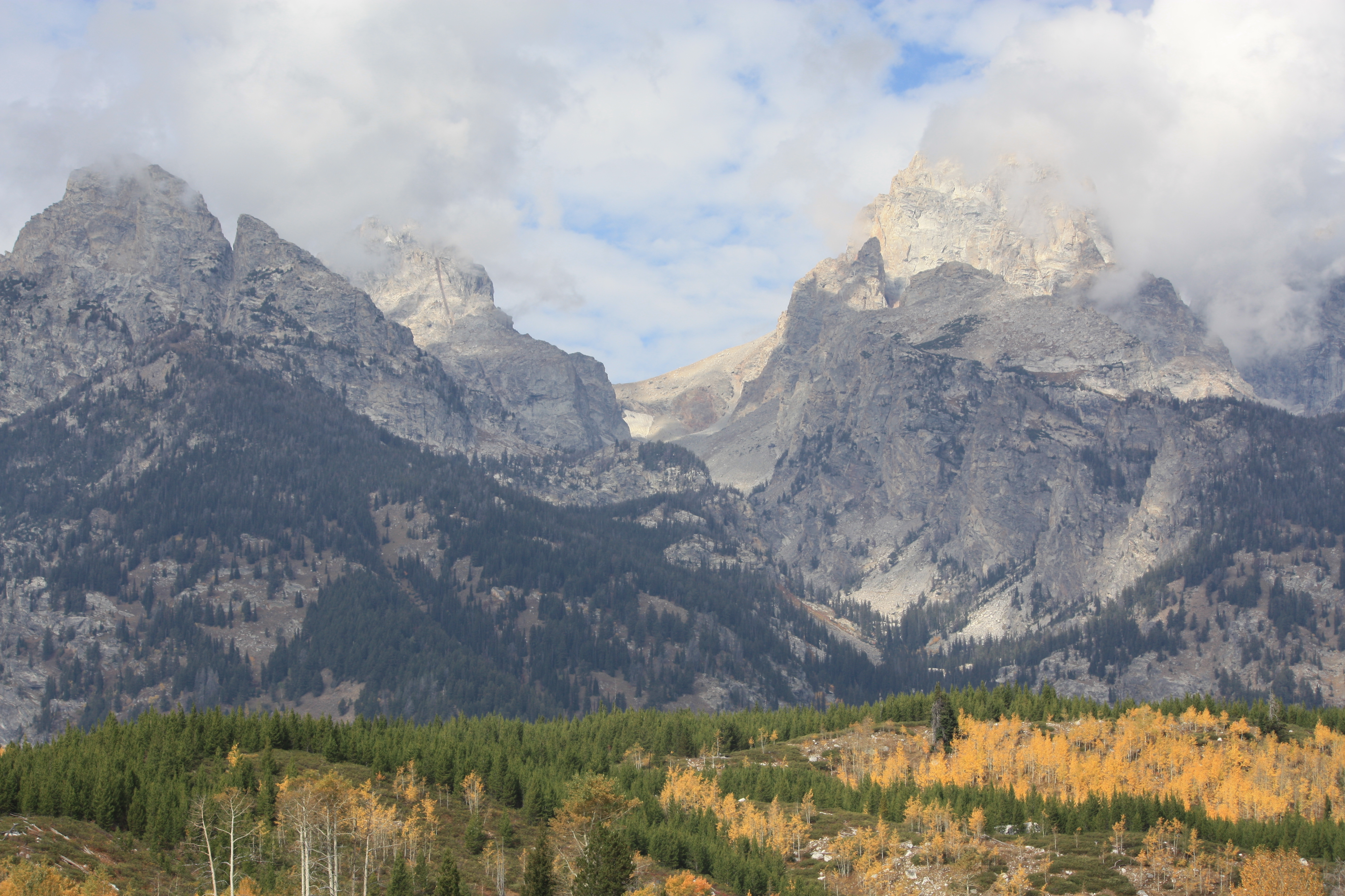
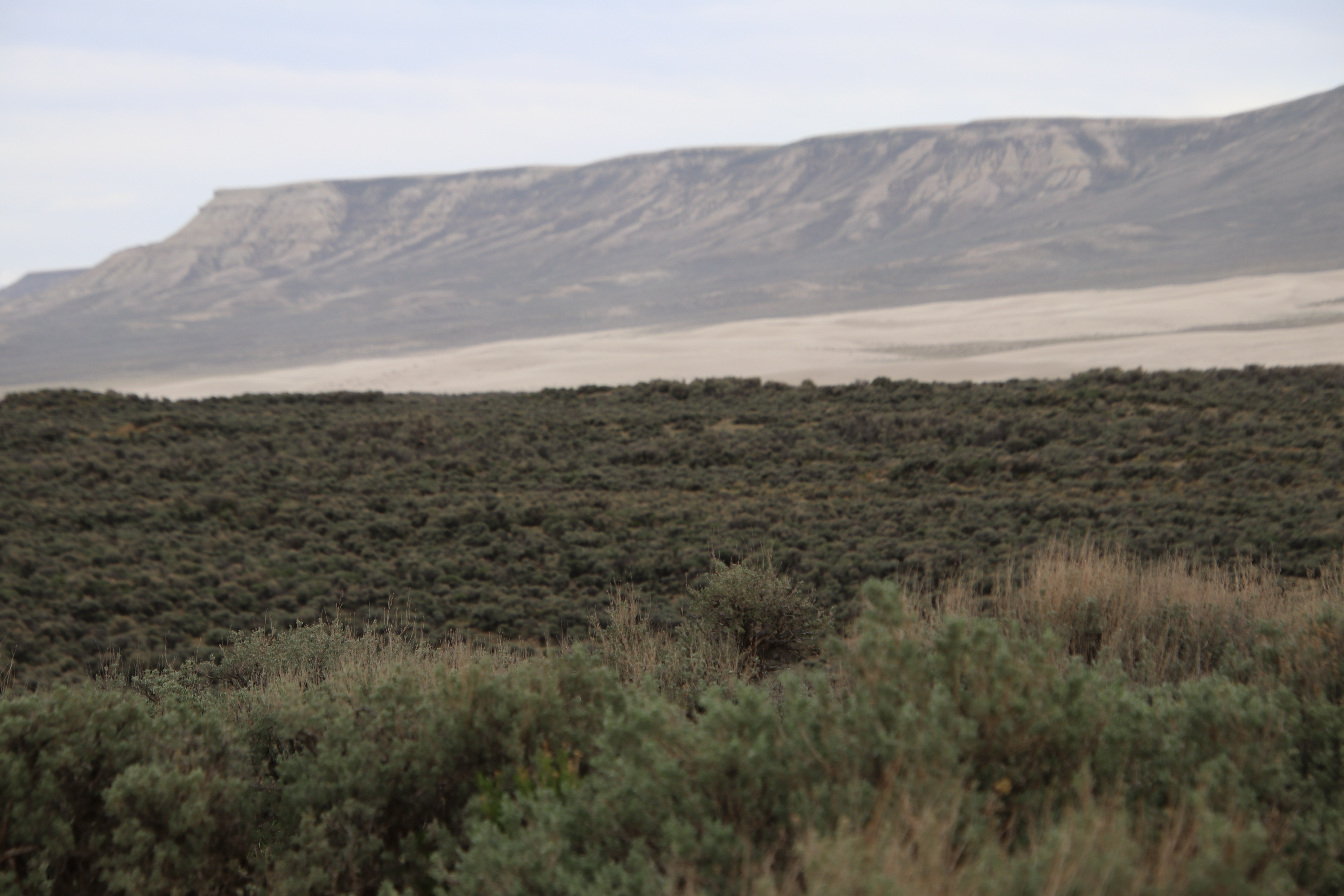
As we began our trek into the desert, our eyes were drawn to the snow-capped peaks of the Wind River range to the west. We rarely lost sight of these mountains that rim the western edge of the desert and helped us maintain our bearing. The landscape gradually descends into sagebrush steppes seen in the foreground of this photograph. This pristine stretch of rolling sagebrush sea is known for exceptional wildlife habitat, supporting the world’s longest mule deer migration corridor, huge herds of elk that summer in the Wind Rivers, plus pronghorn, golden eagles, red fox, Greater sage grouse and hundreds of other sagebrush-dependent species. Wyoming big sagebrush is most common but other sage varieties exist in the Red Desert: basin big sagebrush; mountain big sagebrush; silver sagebrush; black sagebrush; and alkali sagebrush. At least 50 species of perennial grasses occur in sagebrush-dominated habitats of the Red Desert.

The Red Desert is informally divided between the north desert and the south. In total, it encompasses a 10-million-acre expanse that includes Native American petroglyphs and fascinating geological formations of a volcanic field estimated between 1-3 million years old. The California/Oregon and Mormon Trails carved deep ruts into the landscape as thousands of wagon trains carrying European and American immigrants headed west and the deep impressions are still visible across the prairie. The Red Desert covers a vast swath of southwestern Wyoming and beyond, past the Utah and Colorado borders.

Our research into a visit to the desert cautions visitors to have spare tires, extra gasoline, and forget cell phone coverage. Great distances between road signs (with and without bullet holes) leave travelers wondering if they have made a wrong turn (which we did) and wondering if we were lost (we were). Willy, our Jeep can cover a lot of miles on a tank of gasoline, but we nearly ran out, which was a scary experience. Driving over washboard gravel roads left Willy with rattles we have yet to eliminate and at times it felt like I could walk faster than we were traveling. The dust we raised discouraged me of that notion.

Over the last century, unbranded and unclaimed horses were left to graze on public tracts of land in the Red Desert and are protected by the Wild and Free Roaming Horses and Burros Act of 1971. The Bureau of Land Management (BLM) manage the horses and when an over-population occurs, excess animals are gathered, removed and offered to the general public for adoption.
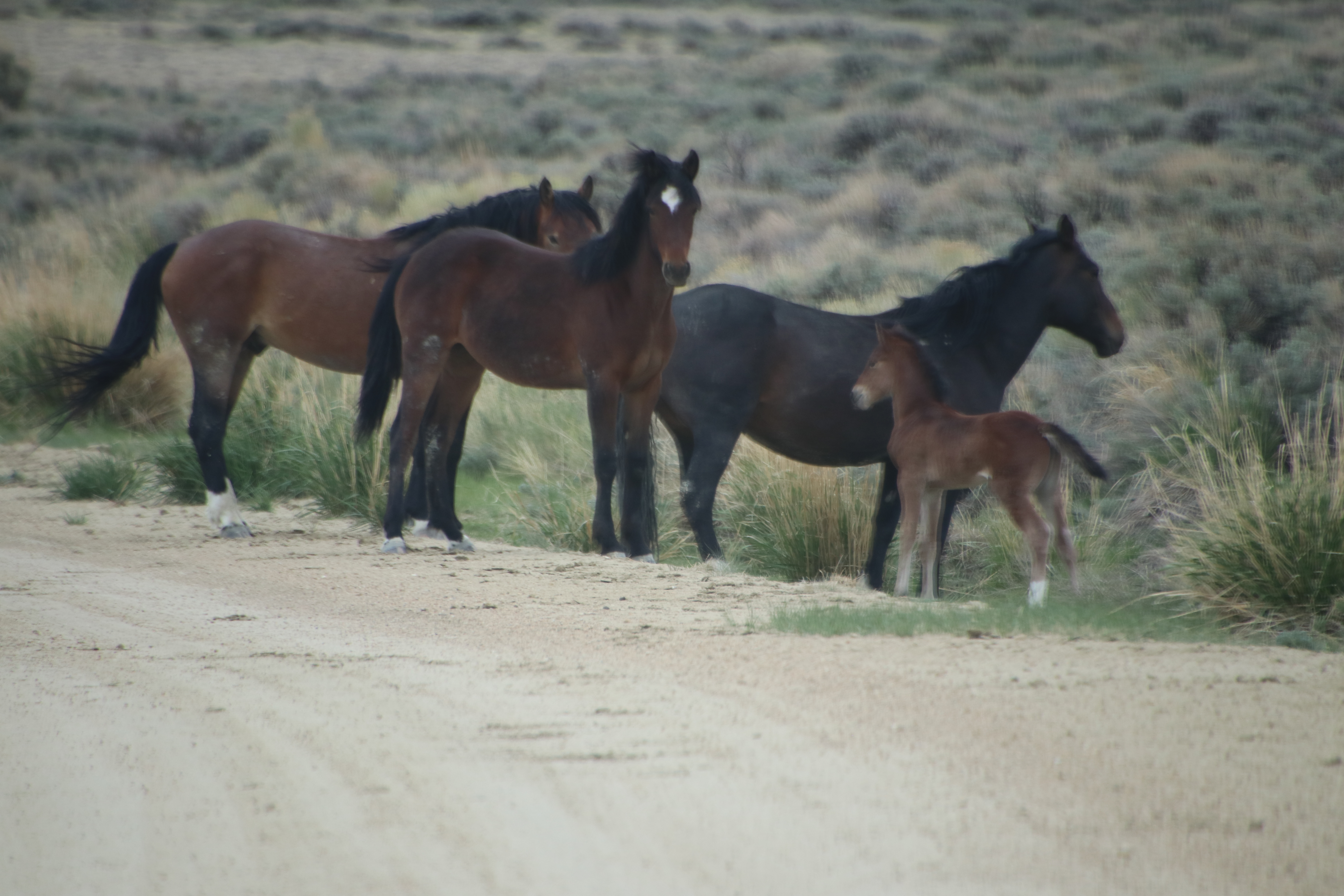

Horses in North America became extinct about 10,000 years ago, which remains an unsolved mystery, but were re-introduced by Spaniard Hernando Cortez in the 1500’s. The horse became re-established in Wyoming sometime in the 1600-1700’s and became vital to the transportation of Plains Indians, fur trappers and mountain men, immigrants, Pony Express riders and cattle and sheep ranchers.
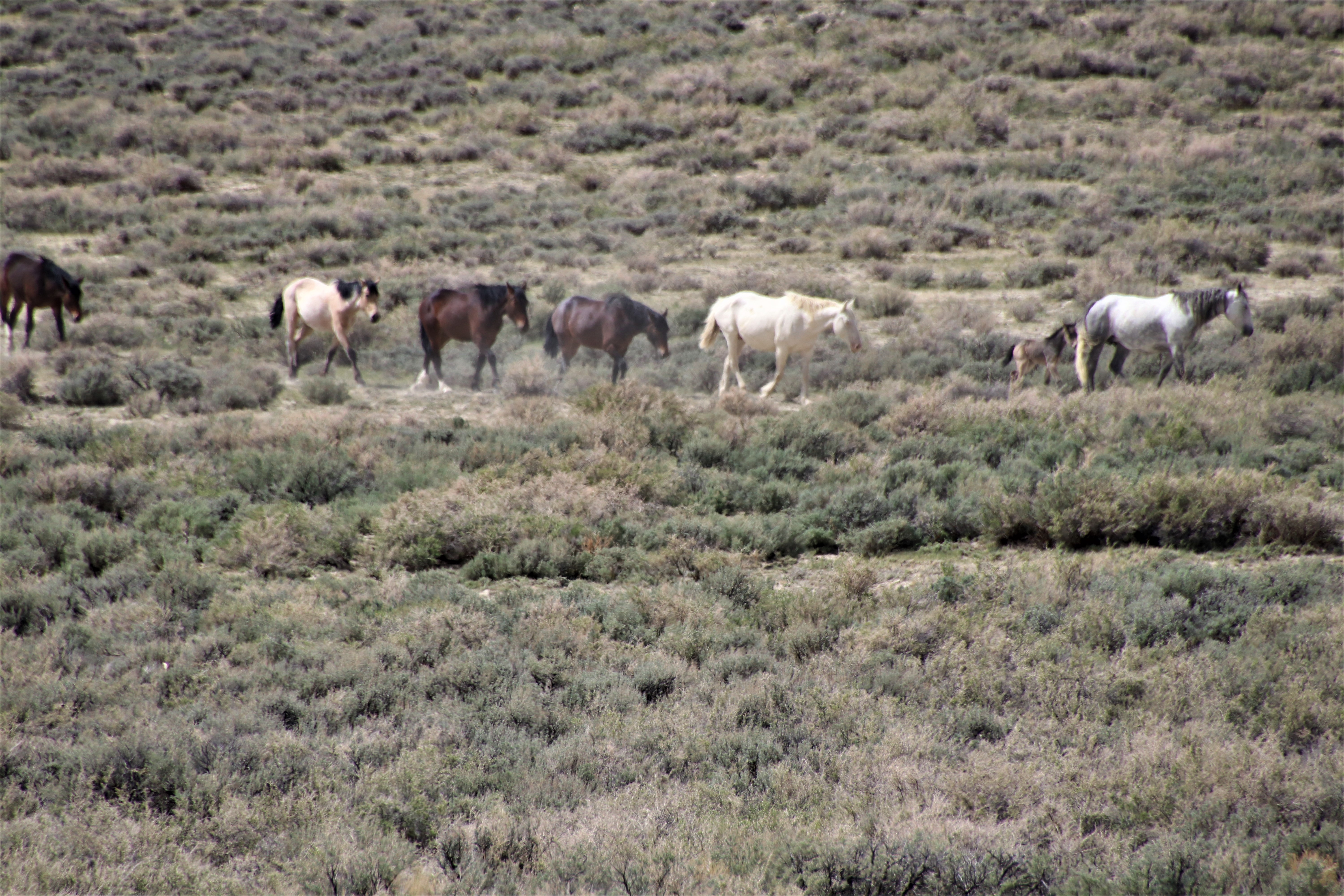
According to the BLM, most of the wild horses in southwest Wyoming are descended from domestic stock, including Thoroughbred; Morgan, Arabian, Bashkir Curly, Pinto, Appaloosa; Quarter Horse and Paint.
Large volumes of sand accumulated on the banks of the Big Sandy and Little Sandy Rivers northeast of Rock Springs and during the glacial melting from the Wind River Mountains, westerly winds over the past 20,000 years have moved the sand eastward across the Continental Divide and into the Great Divide Basin. The Killpecker Sand Dunes stretch 100 miles, 75 miles or 50 miles, depending on the sources on the subject and cover approximately 109,000 acres. It can safely be stated they range from one to three miles in width. These living dunes are one of North America’s largest fields and perform a vital function of storing snowmelt and rain which support vegetation and wildlife.
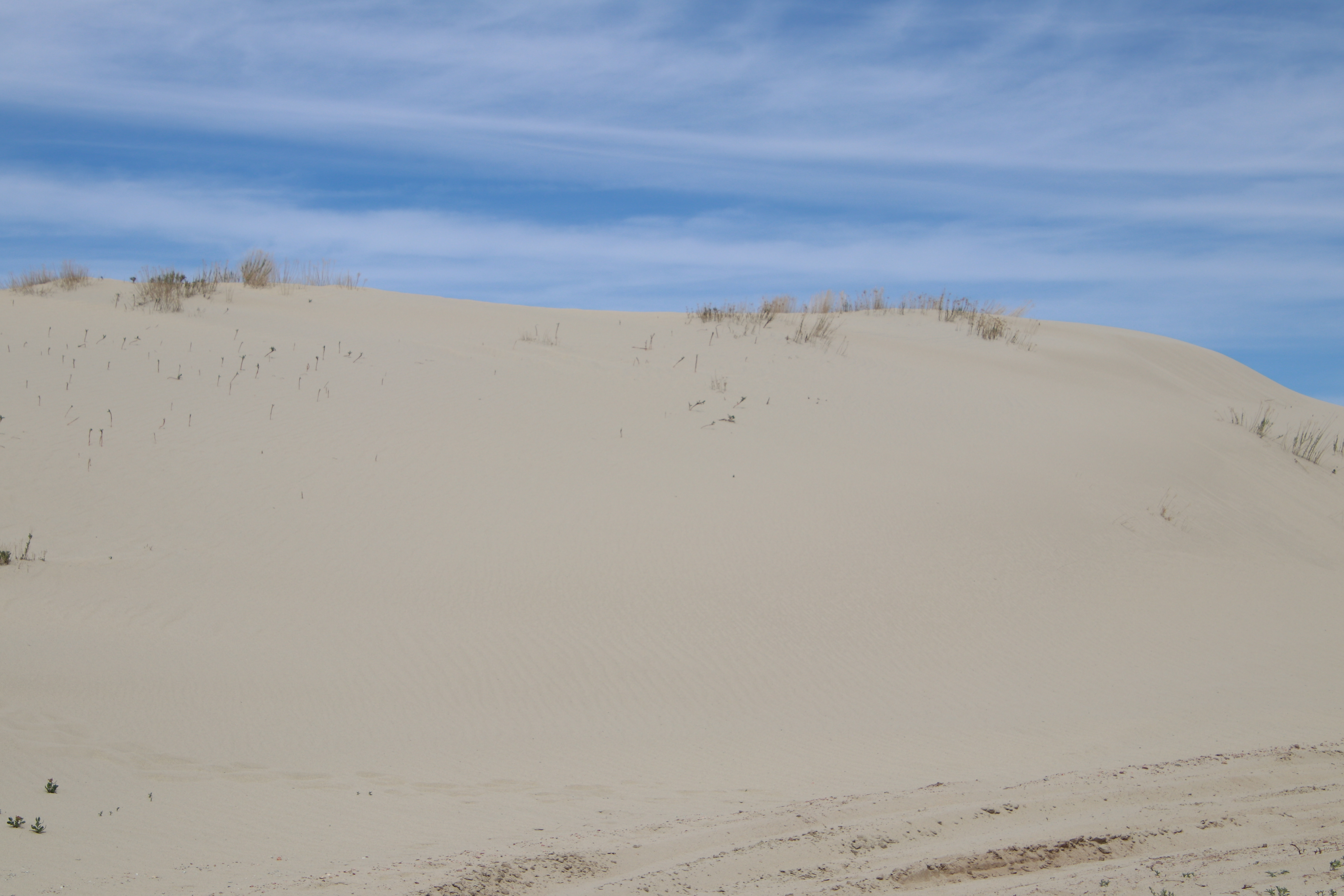
Tire tracks at the lower right corner were made by three black SUV’s loaded with photographic equipment. When I approached on foot, a man was lying on his back on the dune, apparently napping. The vehicles were pulled off to the side of the road, doors flung open and a group of people were milling around. The napping fellow stood when he saw me and explained, in a crisp British accent, they were traveling to the dunes’ wilderness study area when they got mired in the sand and had to dig out. He advised against trying it, emphatic that if we got stuck, “who you gonna call?” Not to mention no cell phone coverage. I explained I was only trying to get a close-up of the dunes and walked, leaving our jeep and trailer behind because we felt driving to it was risky. The shifting sands can make travel an uncertain enterprise!

Dune beetles and other insects as well as small mammals such as shrews, white-footed mice and kangaroo rats inhabit the dunes and provide food for owls, eagles, bobcats and other predators. Short-lived summer ponds at the base of the dunes support migratory shore birds and waders, as well as habitat for salamanders and freshwater shrimp.

We were surprised to learn that an area of the dunes is open to dune buggies for recreation. A sign is posted along the road stating off-road vehicles should not be operated “in a manner to cause damage or disturbance to soil, wildlife and habitat or vegetative resources.” This seems like a contradiction, as joy riding across the dunes clearly does not meet this standard.

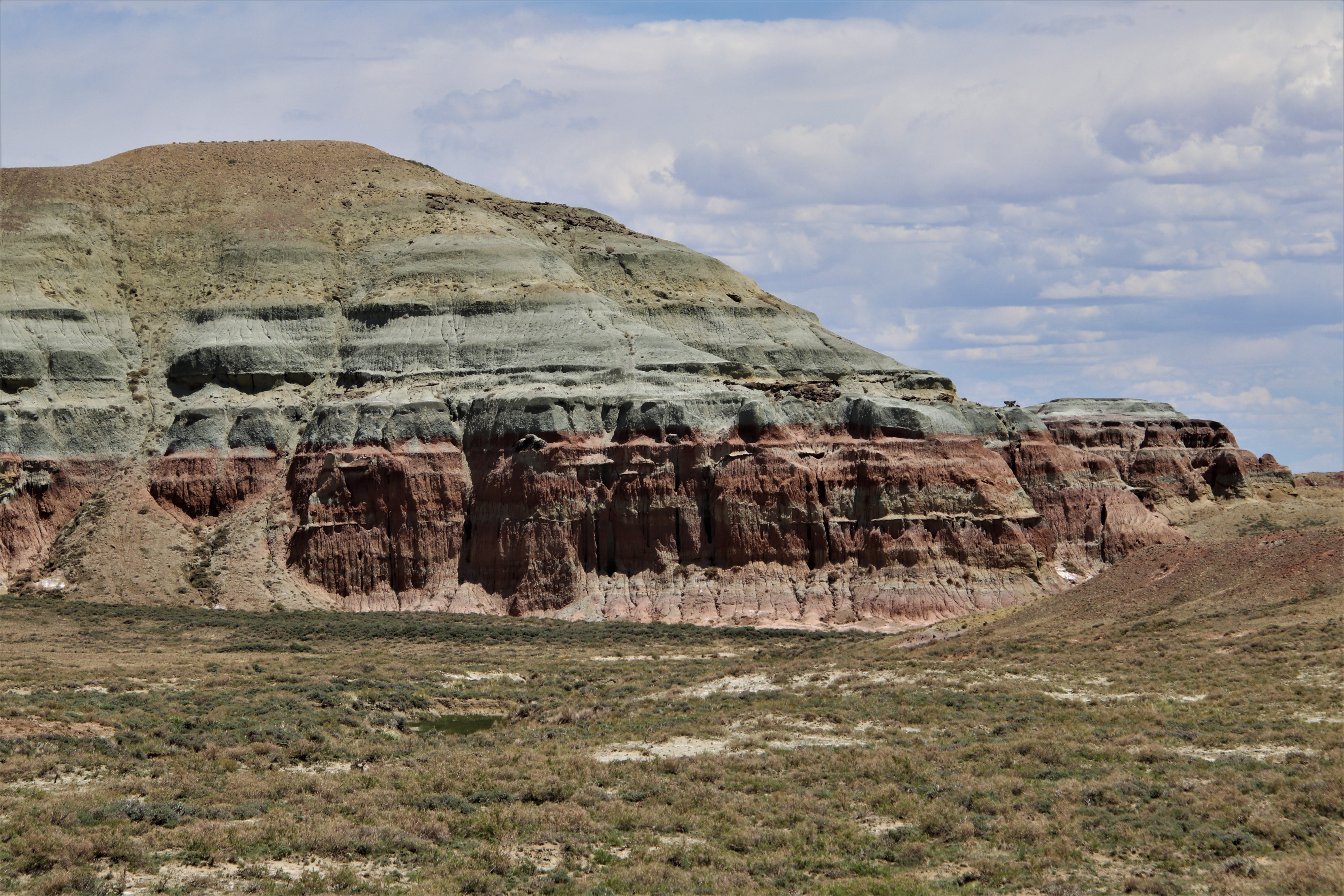
Remnant of an ancient volcanic eruption, The Boar’s Tusk rises approximatey 400 feet above the valley floor. The Red Desert’s northern, southern and eastern bounding ranges are made up of concentrated zones of thrust of chrystalline rocks into sharp-margined uplifts through the earth’s crust. “Every age of earth is represented and practically every kind of rock known on earth is found there, from commoners like granite and sandstone, to oddball sodic evaporites of the Green River Basin, primoridial taconites of the Wind Rivers, and the weird and wonderful Wyomingites of the Leucite Hills.” Charles Ferguson, Geologist

“The Red Desert is exceptional in that it is the only place in the western and northern hemispheres where Archean (ancient) crust figures so prominently in mountain building. Ancient granites of the Wind River Mountains form the northern boundary of the desert and are the only rocks in this part of the world so old to be thrust so high. In fact, until very recently Gannett Peak at 4,207 meters would have easily qualified as the planet’s highest Archean rock. You have to go deep into the heart of darkest Africa to find a more extreme situation.” Charles Ferguson, Geologist
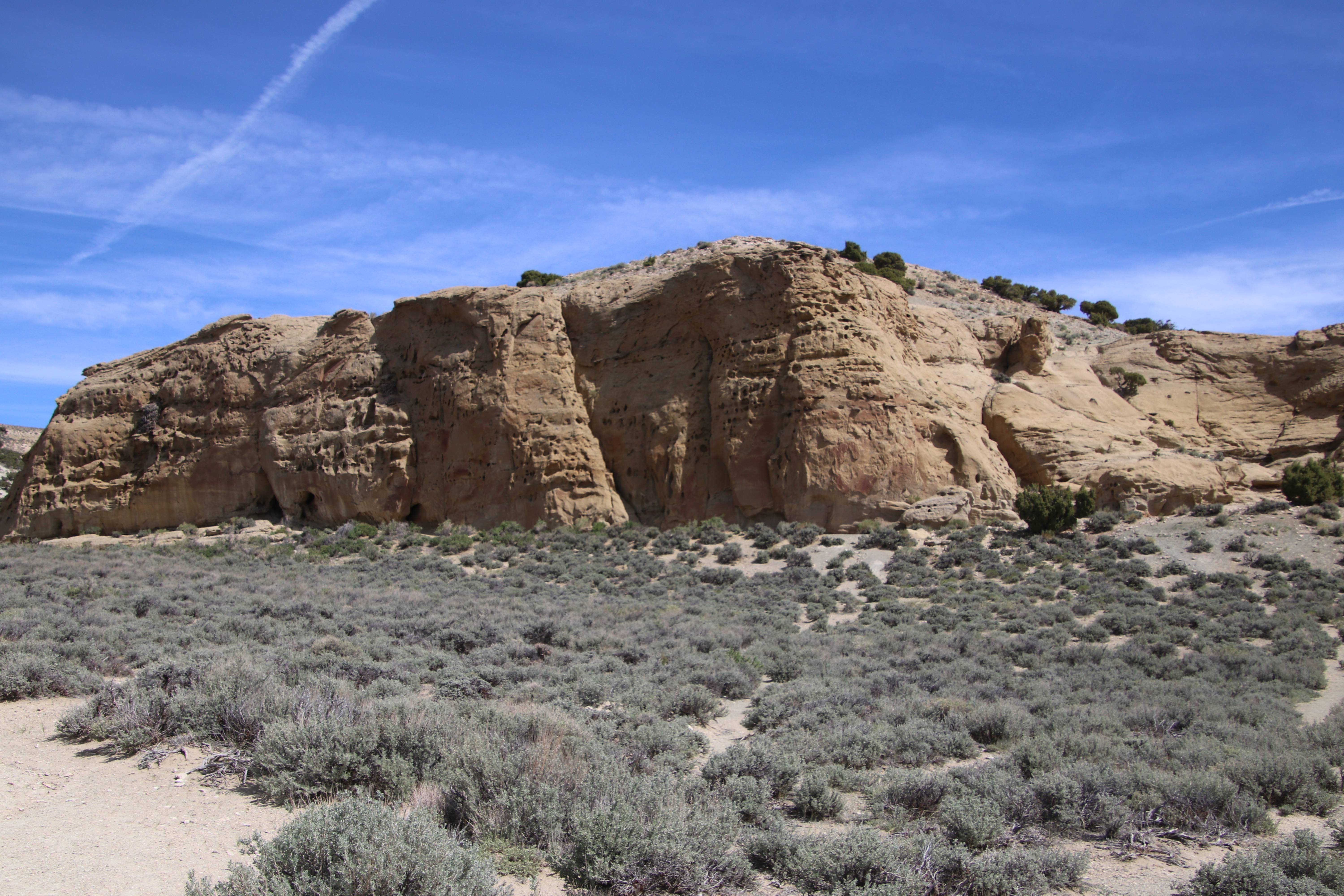
The Red Desert is the ancestral land of a number of Native American tribes, including Shoshone, Yamparika Comanches, Utes, Crow and Bannocks. It is believed that humans first lived in the area sometime before 12,000 BP, or during the transitional period at the end of the last ice age. The Rocky Mountain west and nearby portions of the Great Plains and Great Basin hold abundant rock art features that represent a diversity of ethnic influences, including petroglyphs cut or ground into rock surfaces and pictographs painted onto rock.

White Mountain has images of bison, elk and horse-mounted warriors. Patinated surface includes totem figures, bear paws and turtles.

Unfortunately, White Mountain has suffered from vandalism in recent years, which is a cost of “wreckreation.” People visiting the sites don’t seem to understand the value of these images to the historic record.

The intense blue of the sky and wide-open vistas are magnified by the flatness of the land. Much of Wyoming is hilly or mountainous with something to see on the horizon. On the desert, the earth seems to stretch into endless curvature. The light is bright, making photography difficult as the colors fade and contours flatten out. We hope to revisit the desert and make allowances to be there at dawn and sunset to capture the beauty which is magnified at that time of day.


Many travelers would find little of interest in the desert–hot in summer, cold in winter, and dry, windy, and dusty all the time. Erosion comes not from water, for the most part, but from the wind. We watched this dust devil do its dance across the alkali flat.

The Red Desert is a 15,000 square mile basin filled with sediments from the Paleocene and later eras. The Green River is the western boundary and drains an area of desert but imagine an ancient lake teeming with millions of fish, alligators and large turtles in a lush, tropical forest. The ancient Lake Gosiute flooded the Red Desert entirely and extended into Utah and Colorado. Called the Methuselah of lakes, it existed for 4 million years, filling, spilling, rising and falling. As it retreated and fell below its outlet, constant evaporation caused salinity to increase.

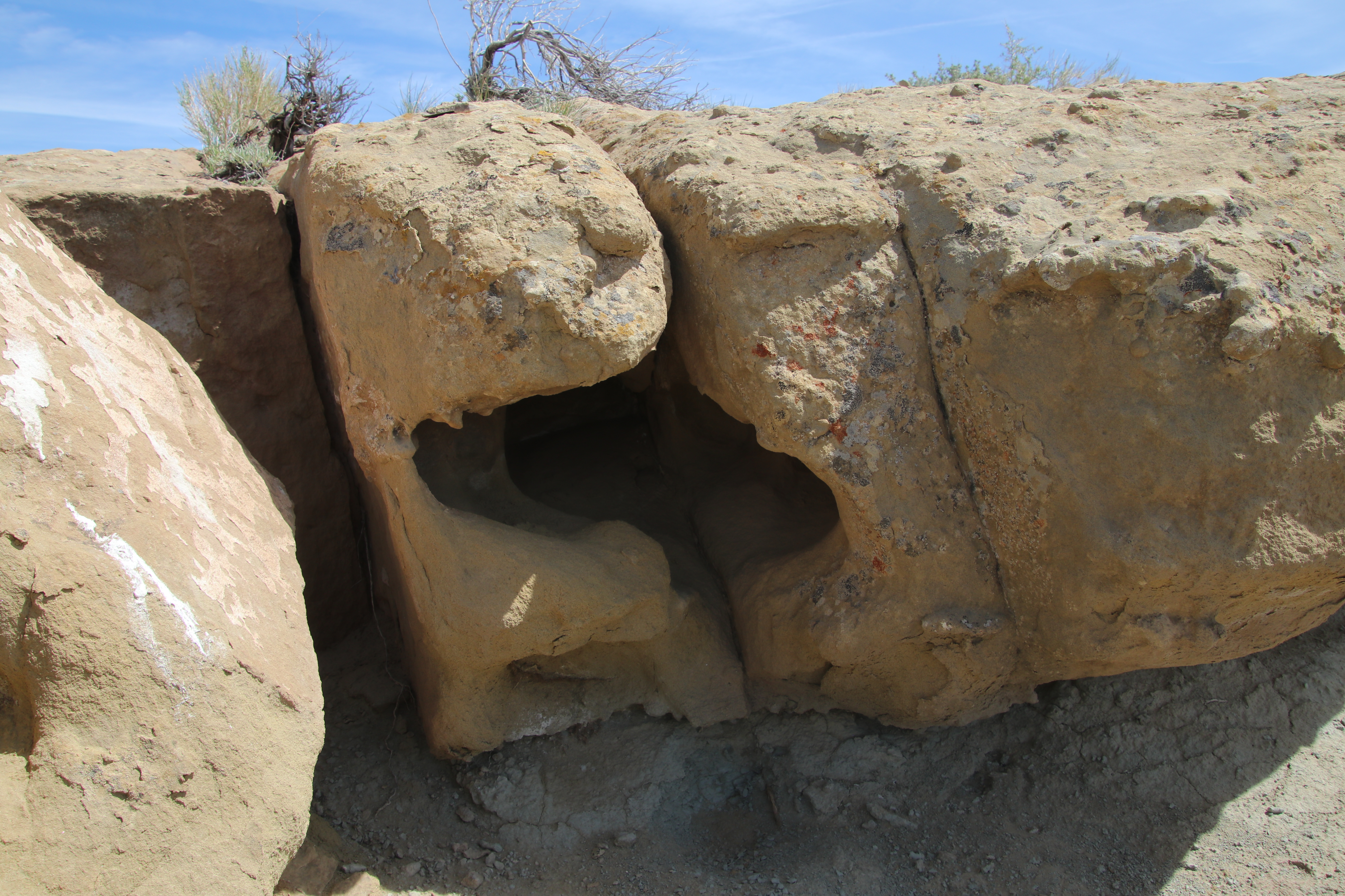
After periods of driving through flat desert topography, the sight of sage-covered hills was refreshing. Finally, something else on the horizon! The Red Desert has such a varied topography, from fields of rock hoodoos to mountain forests, towering buttes and badlands but is predominantly covered by a variety of sagebrush.
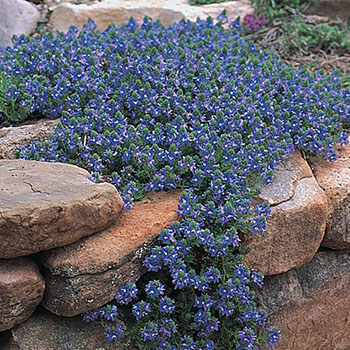
Cannot help but wonder where these lovely periwinkle-colored flowers found enough water to subsist. Surprising to learn that when the Union Pacific came across the Red Desert, 173 species were documented in a botanical survey. Since then over 900 additional species and varieties were recorded. Although surpassed by Yellowstone, the Absaroka and Big Horn ranges, the Red Desert has a larger flora than most of Wyoming’s other mountain ranges, grasslands and desert basins due to the varied topography, geology and geographic location.

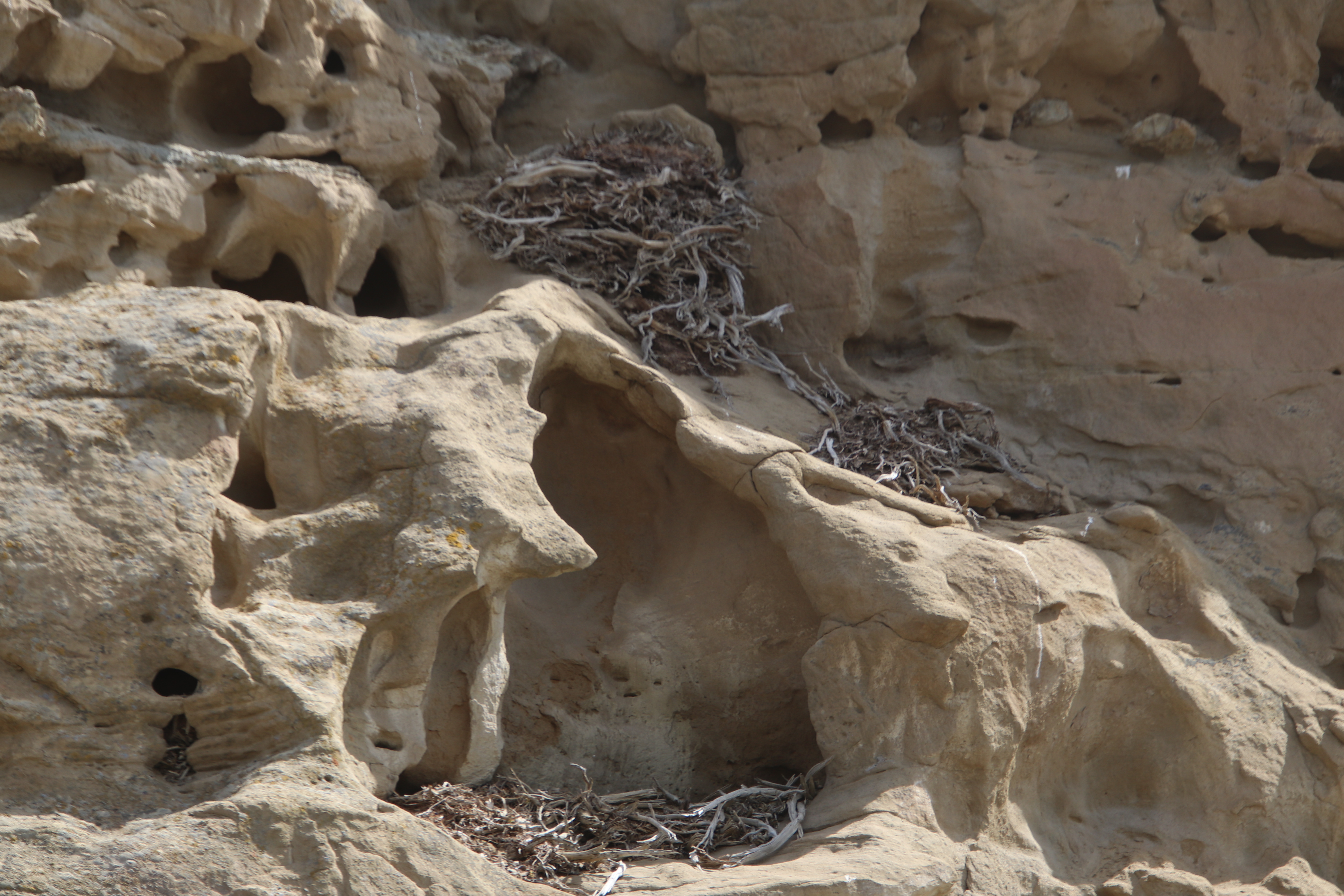
This ruin is located on the map and described as “rock cabin.” We drove past it on County Road 21 and no interpretation signs explain it. It does not appear to be a remnant of the Native American presence on the desert, so it must have been home to a wandering wayfarer, homesteader, rancher or desert rat.

The thunder clouds seemed to gather quickly and we kept a wary eye on the development. While the roadway was graveled, there is no way to ascertain what the surface becomes when wet. Tracks in the dried mud along the bank of the road were an indication of a battle between a vehicle and the elements that still looked recent. We decided to cut our evening short, much to my chagrin, because I was hoping for sunset for some interesting photographs. The clouds were going to prevent that, so we made a hasty departure for civilization in Rock Springs.

Traveling south in the desert into the White Mountains, we arrive at Pilot Butte. At 7,932 feet in elevation, it is the highest point in the White Mountains and is visible for 30 miles in all directions. It is an imposing sight used as a marker by people traveling through the area since prehistoric times. In the 1920’s mail planes used the Butte to mark their course. The route we followed began with the wild horse scenic tour along a high rim with great views eastward.
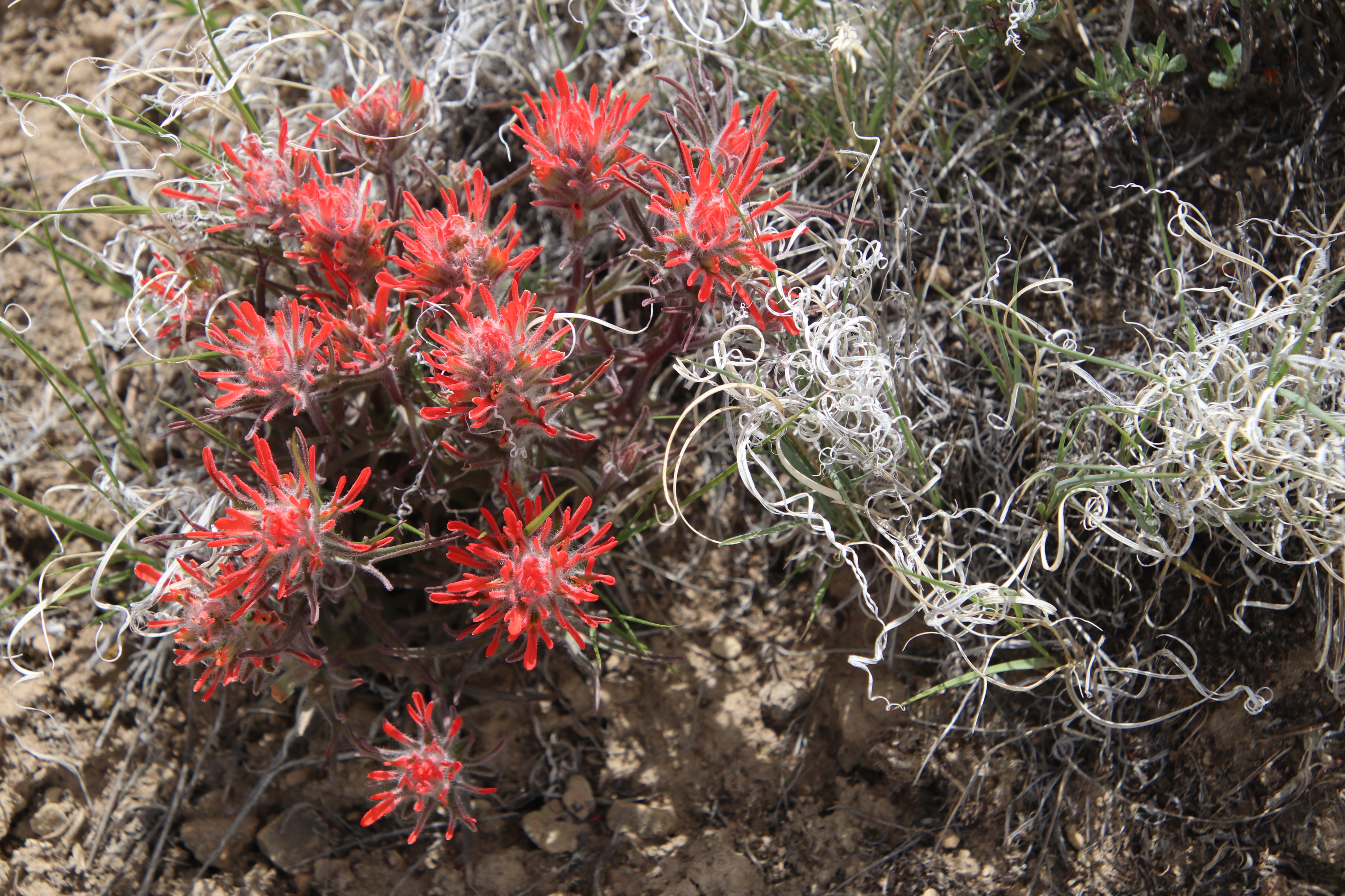
The view to the west of Pilot Butte was sagebrush steppe interspersed with Indian Paint Brush as far as we could see. I have never seen such a large area of this Wyoming state flower, which grows wherever sagebrush proliferate.

We traveled on to Green River and found the topography between Rock Springs and Green River to be fascinating. All the trips passing through this area on I-80 don’t do justice to the terrain in the back country and we have many more sites to see in the Red Desert. Next time.


Since I don’t know if I will have the chance of experiencing the Red Desert in real time, I found this guided tour with great photos very informative. Will anxiously await the next adventure of Willy and Tug.
LikeLike
KK, we will plan another trip soon and you are going!
LikeLike